Lake Michigan Loop
I biked the northern part of Lake Michigan in late May and early June 2026 over 12 days. I made it a loop by taking the ferry from Muskegon to Milwaukee. Here are the details.
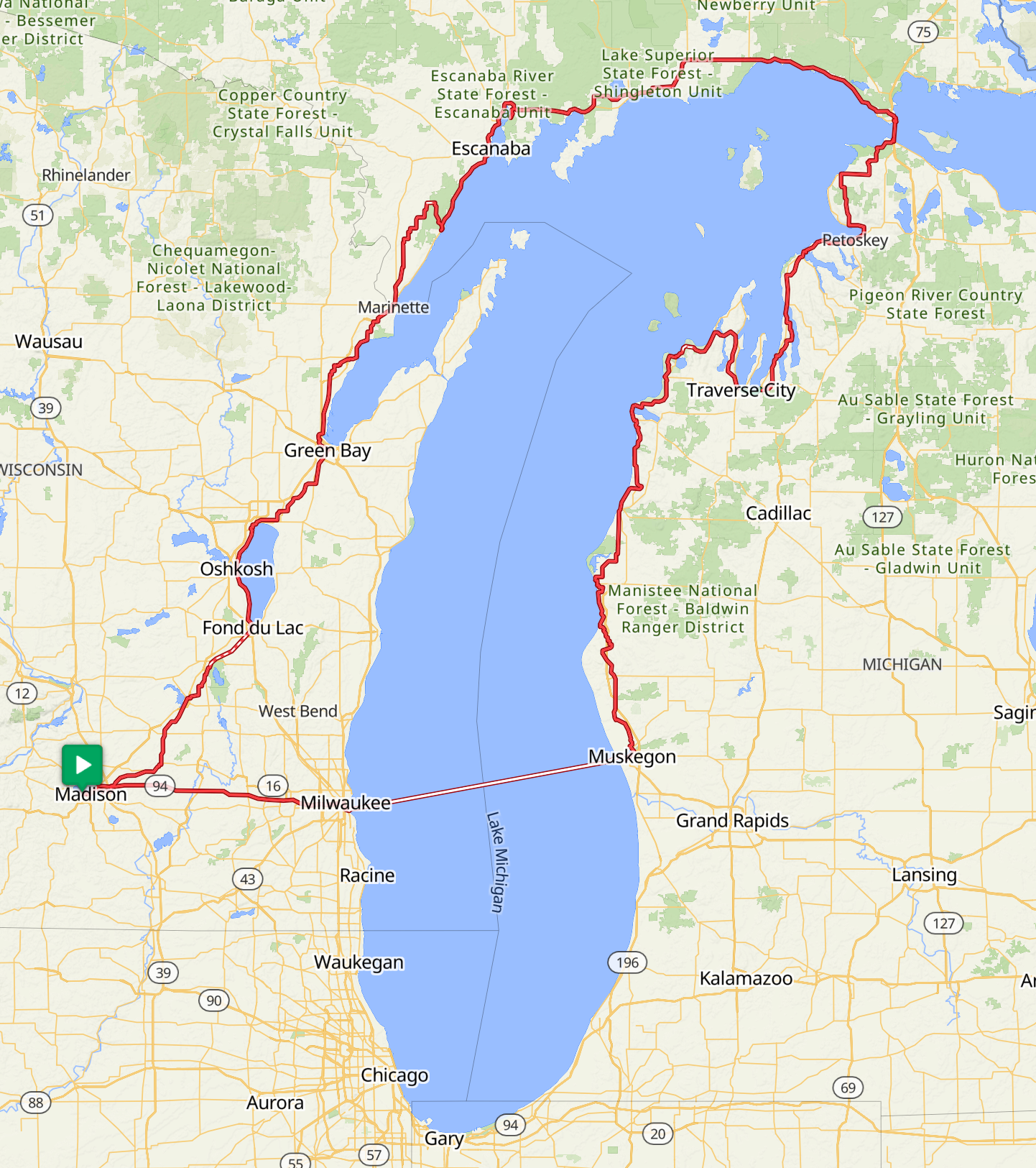
Day 1 — Madison to Fond du Lac
I started on the morning of Memorial Day from Madison and made it to Fond du Lac, around 77 miles. The last 15 miles were on the light gravel of the Wild Goose Trail, which is beautiful. I stayed at a hotel.
Day 2 — Fond du Lac to Green Bay
Around 80 miles. The shorter route suggested by Google Maps and Ride with GPS was on the right side of Lake Winnebago, but I wanted to visit Oshkosh. I visited the EAA Aviation Museum, which was very cool. Google Maps took me along the airport on Knapp Street, which does not provide public access to the museum. It goes through the aviation campground, so following that route means trespassing. This was the first sign that I should have avoided using Google Maps for this trip. The last 12 miles of the Fox River Trail into Green Bay are paved, and that was the only section I rode. I also had to ride through severe rain. I stayed at a hotel after an exhausting day.
Day 3 — Green Bay to North Bay Shore Campground
About 50 miles. I camped at North Bay Shore Campground, which was a fantastic site.
Day 4 — North Bay Shore to Cedar River
About 50 miles. This was the worst day of the trip, mostly because of Google Maps. The correct route is along M-35, but Google Maps tries to avoid highways for bicycles and instead sends you inland. Inland = hills + unpaved roads. The farmland roads in this area are often unpaved and covered with very loose gravel. First, I was chased by an unleashed shepherd dog on one of the farmland county roads. Then I got a flat tire on one of the worst gravel roads near Cedar River Park. I got stuck there with no internet connection, and it was getting dark. Finally, a guy named Tony saved me. He picked me up and took me to a local motel in Cedar River. Thank you, Tony!
Day 5 — Cedar River to Vagabond Campground
Around 55 miles. After surviving the previous night, I stopped relying on Google Maps and started using only Ride with GPS. I continued along M-35. I highly recommend Vagabond Campground.
Day 6 — Vagabond Campground to Manistique
Around 45 miles along US 2. The bike shoulders along the first 20 miles of this section of US 2 were very bad and under construction. Much of the shoulder consisted of rumble strips, which made riding difficult and slow. I stayed in a hotel in Manistique, which has nice beach access.
Day 7 — Manistique to St. Ignace
Around 91 miles along US 2. This section is very scenic and fun to ride. My original plan was to cross the Mackinac Bridge and stay in a hotel in Mackinaw City. Then I used Google Maps inside St. Ignace one more time, and it screwed me again. Bicycles are not allowed to cross the Mackinac Bridge on their own. You need to go to the Bridge Authority building, where they transport you and your bike across the bridge for $15. Getting to that building by bicycle is surprisingly nontrivial. Google Maps suggested approaching from the right side through Straits State Park. The building is directly behind the camping sites, so it looks as if you could simply walk there. One small problem: There are fences with “No Trespassing” signs. I still don’t understand how Google Maps became so unreliable for this trip. It was already dark, so I was forced to camp at Straits State Park next to the bridge. That actually turned out to be a much better option than my original plan. Sometimes making a mistake is not bad after all.
Day 8 — St. Ignace to Charlevoix
Around 70 miles. The correct way to reach the Bridge Authority building is from the left side, near Bridge View Park. The suggested route from Mackinaw City to Petoskey follows a bike path with loose gravel. I avoided that and instead followed U.S. Bicycle Route 35. The section from Harbor Springs to Charlevoix is a paved bike trail and was one of the most scenic parts of the entire trip. I stayed in a hotel in Charlevoix.
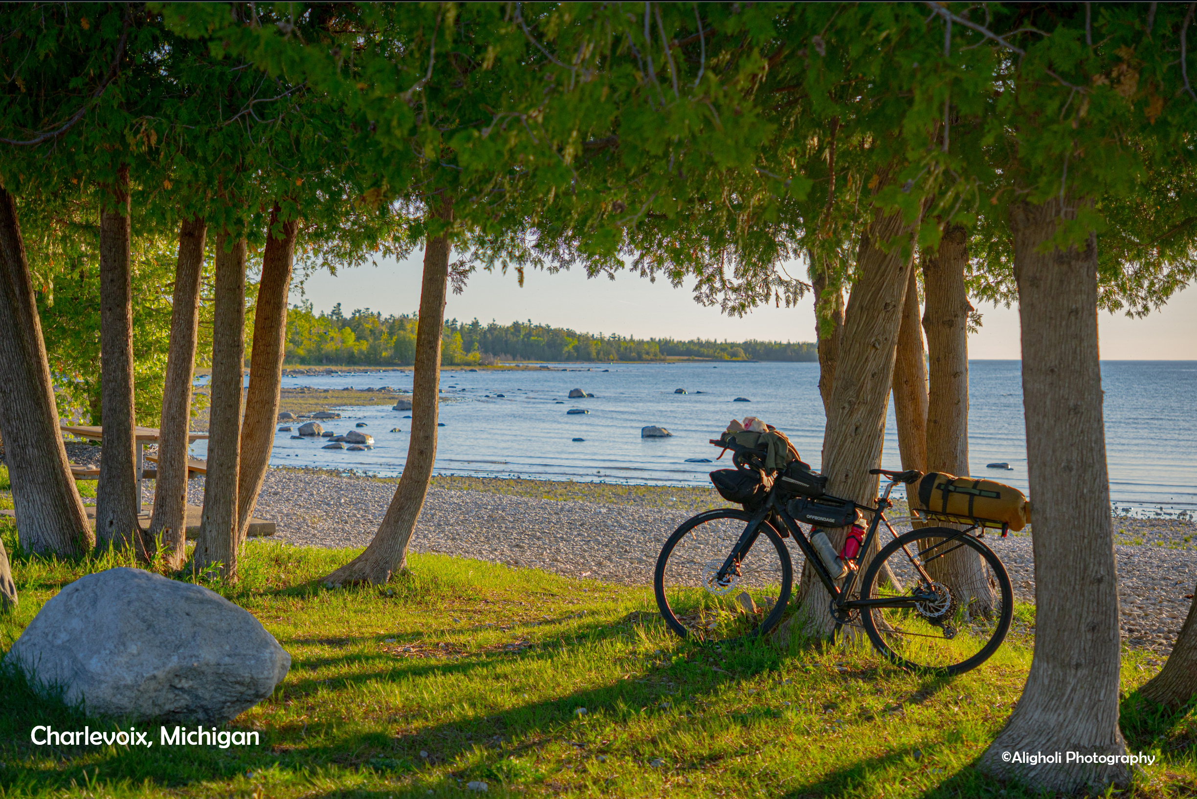
Day 9 — Charlevoix to Traverse City
Around 57 miles along Route 35. I stayed in a hotel in Traverse City.
Day 10 — Traverse City to Manistee
Around 70 miles. Route 35 goes north toward Suttons Bay and Sleeping Bear Dunes. I needed to get back to Madison as soon as possible and didn’t have much energy left for hiking in Sleeping Bear Dunes, so I decided to skip it and go directly to Manistee. Because the direct route goes inland, there are hills. However, going south is much easier because you are generally losing elevation. If you are doing the loop counterclockwise and heading north, I think it is better to follow Route 35 and visit Sleeping Bear Dunes. I stayed in a hotel in Manistee because I had heard there were lots of mosquitoes around the campgrounds near Sleeping Bear Dunes.
Day 11 — Manistee to Muskegon
Around 100 miles. This was the longest day of the entire trip. The first 55 miles from Manistee to Hart were fairly boring. The next 45 miles from Hart to Muskegon were on a very nice paved bike trail. That section was smooth sailing. Again, traveling southbound is mostly downhill and makes for a relatively easy ride. If you are traveling north, it would be more challenging. I stayed in a hotel in Muskegon.
Day 12 — Muskegon to Milwaukee to Madison
I took the Lake Express ferry from Muskegon to Milwaukee. It was raining in Milwaukee, and I was very tired. I decided to take the Badger Bus from Milwaukee back to Madison. You can bring your bicycle on the bus for $10.